 vesseltracker.com
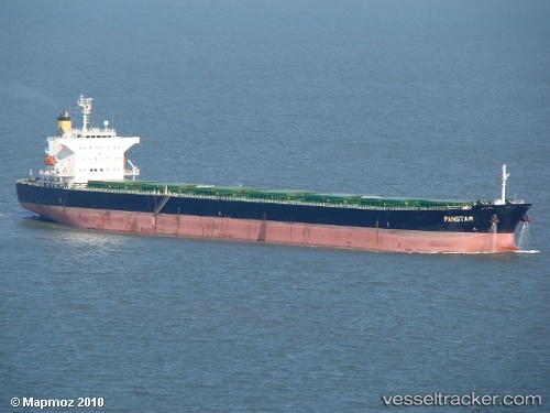
Panstar
Current StatusWhere is the vessel?
Panstar is currently in 182 nm NW of Primorsky Krai, based on AIS data received about 2h ago.
Latest AIS update:
Current position: 47.55131° N, 138.34752° W (182 nm NW of Primorsky Krai)
Average speed (last 7 days): Loading…
Average speed (last 30 days): Loading…
Vessel profile: Panstar is a Bulk Carrier with dimensions 32m x 225m.
This page combines live AIS, route history, probable destination signals, nearby traffic, and port activity for practical vessel monitoring.
The current position of vessel Panstar is 47.55131 lat / -138.34752 lng. Updated: 2026-04-22 23:54:15 UTCNearest reference points:
- 249 nm NE of Lukovica pri Domzalah
Details:
Live Vessel Panstar Analytics (details, animations, etc.)
Recent AIS points (UTC):
2026-04-22 19:56:43 UTC · 47.67796, -139.47356 · SOG 11.5 kn · COG 99°2026-04-22 21:31:11 UTC · 47.62908, -139.02382 · SOG 11.7 kn · COG 100°
2026-04-22 22:26:11 UTC · 47.60010, -138.76173 · SOG 11.7 kn · COG 101°
2026-04-22 23:54:15 UTC · 47.55131, -138.34752 · SOG 11.4 kn · COG 98°