 vesseltracker.com
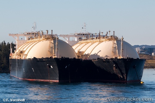
 BERING ENERGY
Current Status
Where is the vessel?
BERING ENERGY is currently in 123 nm S of Minachi, based on AIS data received about 241d ago.
Latest AIS update:
Current position: 31.82430° N, 136.34273° E (123 nm S of Minachi)
Average speed (last 7 days): Loading…
Average speed (last 30 days): Loading…
Vessel profile: BERING ENERGY is a LNG Tanker with dimensions 284m x 44m.
This page combines live AIS, route history, probable destination signals, nearby traffic, and port activity for practical vessel monitoring.
The current position of vessel BERING ENERGY is 31.82430 lat / 136.34273 lng. Updated: 2025-08-19 10:36:42 UTCNearest reference points:
- 88 nm SE of Minachi
- 195 nm SE of Minachi
- 23 nm S of Minachi
Currently sailing under the flag of Marshall Islands ![]()
BERING ENERGY built in 1978 year
Deadweight:
72555 tDetails:
Live Vessel BERING ENERGY Analytics (details, animations, etc.)
Recent AIS points (UTC):
2025-08-19 10:36:42 UTC · 31.82430, 136.34273 · SOG 25.6 kn · COG 106°