 vesseltracker.com
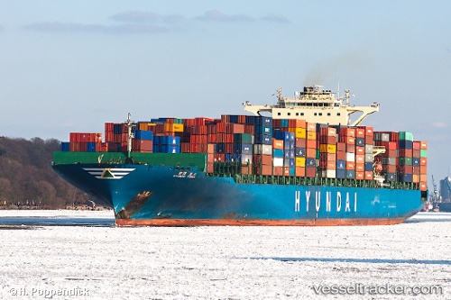
Hyundai Force
Current StatusWhere is the vessel?
Hyundai Force is currently in Near NAVEGANTES, based on AIS data received about 1h ago.
Latest AIS update:
Current position: 26.89828° S, 48.66112° W (Near NAVEGANTES)
Average speed (last 7 days): Loading…
Average speed (last 30 days): Loading…
Vessel profile: Hyundai Force is a Container Ship with dimensions 46m x 339m.
This page combines live AIS, route history, probable destination signals, nearby traffic, and port activity for practical vessel monitoring.
The current position of vessel Hyundai Force is -26.89828 lat / -48.66112 lng. Updated: 2026-03-26 07:46:09 UTCNearest reference points:
- Near Itajai
- 10 nm NE of CAMBORIU
- 32 nm E of Caioba
Details:
Live Vessel Hyundai Force Analytics (details, animations, etc.)
Recent AIS points (UTC):
2026-03-26 01:43:11 UTC · -26.89818, -48.66110 · SOG 0 kn · COG 99°2026-03-26 03:55:11 UTC · -26.89828, -48.66103 · SOG 0 kn · COG 99°
2026-03-26 05:52:10 UTC · -26.89818, -48.66082 · SOG 0 kn · COG 99°
2026-03-26 07:46:09 UTC · -26.89828, -48.66112 · SOG 0 kn · COG 99°