 vesseltracker.com
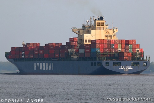
Hyundai Forward
Current StatusWhere is the vessel?
Hyundai Forward is currently in 23 nm W of Tatoosh Island, based on AIS data received about 3h ago.
Latest AIS update:
Current position: 48.46283° N, 125.30708° W (23 nm W of Tatoosh Island)
Average speed (last 7 days): Loading…
Average speed (last 30 days): Loading…
Vessel profile: Hyundai Forward is a Container Ship with dimensions 32m x 295m.
This page combines live AIS, route history, probable destination signals, nearby traffic, and port activity for practical vessel monitoring.
The current position of vessel Hyundai Forward is 48.46283 lat / -125.30708 lng. Updated: 2026-04-10 07:33:17 UTCNearest reference points:
- 21 nm NW of Tatoosh Island
- Near Clallam Bay
- Near Nanaimo
Details:
Live Vessel Hyundai Forward Analytics (details, animations, etc.)
Recent AIS points (UTC):
2026-04-10 01:35:58 UTC · 48.49535, -127.51027 · SOG 14.7 kn · COG 92°2026-04-10 03:47:32 UTC · 48.48338, -126.69837 · SOG 14.5 kn · COG 88°
2026-04-10 06:05:33 UTC · 48.46338, -125.84570 · SOG 14.5 kn · COG 90°
2026-04-10 07:33:17 UTC · 48.46283, -125.30708 · SOG 14.8 kn · COG 88°