 vesseltracker.com
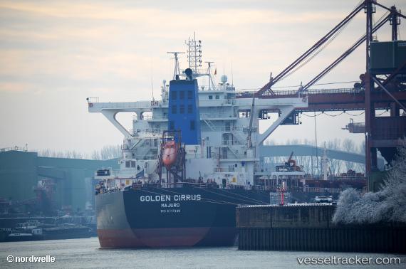
Golden Cirrus
Current StatusWhere is the vessel?
Golden Cirrus is currently in 11 nm SE of Boseong-gun, based on AIS data received about 1h ago.
Latest AIS update:
Current position: 34.65411° N, 127.98507° E (11 nm SE of Boseong-gun)
Average speed (last 7 days): Loading…
Average speed (last 30 days): Loading…
Vessel profile: Golden Cirrus is a Bulk Carrier with dimensions 45m x 292m.
This page combines live AIS, route history, probable destination signals, nearby traffic, and port activity for practical vessel monitoring.
The current position of vessel Golden Cirrus is 34.65411 lat / 127.98507 lng. Updated: 2026-03-30 13:48:26 UTCNearest reference points:
- 13 nm SE of Boseong-gun
- 13 nm SE of Namhae-gun
- 15 nm SE of Boseong-gun
Details:
Live Vessel Golden Cirrus Analytics (details, animations, etc.)
Recent AIS points (UTC):
2026-03-30 07:28:40 UTC · 34.32521, 127.96779 · SOG 12.9 kn · COG 10°2026-03-30 09:46:16 UTC · 34.65185, 127.97938 · SOG 2.4 kn · COG -1°
2026-03-30 11:22:07 UTC · 34.65398, 127.98506 · SOG 0.1 kn · COG -1°
2026-03-30 13:48:26 UTC · 34.65411, 127.98507 · SOG 0.4 kn · COG -1°