 vesseltracker.com
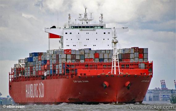
Cap San Juan
Current StatusWhere is the vessel?
Cap San Juan is currently in 43 nm E of Slipi, based on AIS data received less than 1h ago.
Latest AIS update:
Current position: 6.33465° N, 107.49135° E (43 nm E of Slipi)
Average speed (last 7 days): Loading…
Average speed (last 30 days): Loading…
Vessel profile: Cap San Juan is a Container Ship with dimensions 48m x 332m.
This page combines live AIS, route history, probable destination signals, nearby traffic, and port activity for practical vessel monitoring.
The current position of vessel Cap San Juan is 6.33465 lat / 107.49135 lng. Updated: 2026-04-21 21:22:26 UTCNearest reference points:
- 36 nm SW of Slipi
- 11 nm N of Gombong
- 46 nm E of Kakap Natuna Terminal
Details:
Live Vessel Cap San Juan Analytics (details, animations, etc.)
Recent AIS points (UTC):
2026-04-21 18:10:06 UTC · 5.66823, 107.05170 · SOG 15 kn · COG 32°2026-04-21 19:28:18 UTC · 5.94382, 107.22890 · SOG 15 kn · COG 34°
2026-04-21 19:42:06 UTC · 5.99185, 107.26090 · SOG 15 kn · COG 34°
2026-04-21 21:22:26 UTC · 6.33465, 107.49135 · SOG 14.6 kn · COG -1°