 vesseltracker.com
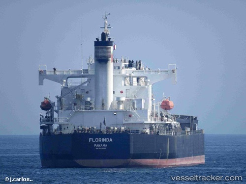
 FLORINDA
Current Status
Where is the vessel?
FLORINDA is currently in Near Taboneo, based on AIS data received less than 1h ago.
Latest AIS update:
Current position: 3.70749° S, 114.43912° E (Near Taboneo)
Average speed (last 7 days): Loading…
Average speed (last 30 days): Loading…
Vessel profile: FLORINDA is a Bulk Carrier with dimensions 32m x 189m.
This page combines live AIS, route history, probable destination signals, nearby traffic, and port activity for practical vessel monitoring.
The current position of vessel FLORINDA is -3.70749 lat / 114.43912 lng. Updated: 2026-03-30 01:26:40 UTCNearest reference points:
- Near Taboneo
- Near BANJARMASIN
- Near Bunati
Currently sailing under the flag of Marshall Islands ![]()
FLORINDA built in 2008 year
Deadweight:
58791 tDetails:
Live Vessel FLORINDA Analytics (details, animations, etc.)
Recent AIS points (UTC):
2026-03-29 20:20:41 UTC · -3.70777, 114.43922 · SOG 0 kn · COG 90°2026-03-29 21:56:40 UTC · -3.70767, 114.43914 · SOG 0 kn · COG 93°
2026-03-30 00:02:43 UTC · -3.70813, 114.43915 · SOG 0 kn · COG 86°
2026-03-30 01:26:40 UTC · -3.70749, 114.43912 · SOG 0 kn · COG 107°