 vesseltracker.com
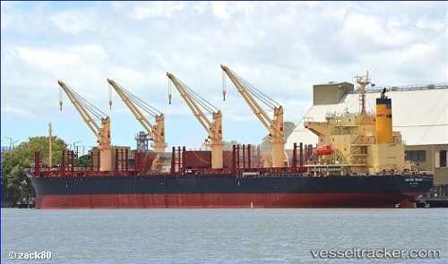
 Union Mark
Current Status
Where is the vessel?
Union Mark is currently in Near Dejima, based on AIS data received less than 1h ago.
Latest AIS update:
Current position: 34.21534° N, 135.09906° E (Near Dejima)
Average speed (last 7 days): Loading…
Average speed (last 30 days): Loading…
Vessel profile: Union Mark is a Bulk Carrier with dimensions 180m x 180m.
This page combines live AIS, route history, probable destination signals, nearby traffic, and port activity for practical vessel monitoring.
The current position of vessel Union Mark is 34.21534 lat / 135.09906 lng. Updated: 2026-04-14 15:59:29 UTCNearest reference points:
- Near KADA
- Near SHIMOTSU
- Near Awaji
Currently sailing under the flag of Marshall Is ![]()
Details:
Live Vessel Union Mark Analytics (details, animations, etc.)
Recent AIS points (UTC):
2026-04-14 09:59:30 UTC · 34.21734, 135.09790 · SOG 0.1 kn · COG 211°2026-04-14 11:26:13 UTC · 34.21643, 135.09927 · SOG 0.1 kn · COG 262°
2026-04-14 13:41:12 UTC · 34.21539, 135.09917 · SOG 0.1 kn · COG 302°
2026-04-14 15:59:29 UTC · 34.21534, 135.09906 · SOG 0.1 kn · COG 304°