 vesseltracker.com
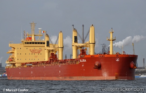
 ELISA
ELISA
Current Status
Where is the vessel?
ELISA is currently in 18 nm N of Okwori, based on AIS data received about 1h ago.
Latest AIS update:
Current position: 4.15037° N, 6.92538° E (18 nm N of Okwori)
Average speed (last 7 days): Loading…
Average speed (last 30 days): Loading…
Vessel profile: ELISA is a Bulk Carrier with dimensions 32m x 189m.
This page combines live AIS, route history, probable destination signals, nearby traffic, and port activity for practical vessel monitoring.
The current position of vessel ELISA is 4.15037 lat / 6.92538 lng. Updated: 2026-04-19 17:41:22 UTCNearest reference points:
- 21 nm SW of Bonny
- 12 nm N of Okwori
- Near Bonny
Currently sailing under the flag of Marshall Islands ![]()
ELISA built in 2016 year
Deadweight:
58623 tDetails:
Live Vessel ELISA Analytics (details, animations, etc.)
Recent AIS points (UTC):
2026-04-19 13:59:13 UTC · 4.15104, 6.92330 · SOG 0.1 kn · COG 158°2026-04-19 16:23:12 UTC · 4.15118, 6.92395 · SOG 0 kn · COG 183°
2026-04-19 16:41:22 UTC · 4.15105, 6.92371 · SOG 0.1 kn · COG 170°
2026-04-19 17:41:22 UTC · 4.15037, 6.92538 · SOG 0.1 kn · COG 251°