 vesseltracker.com
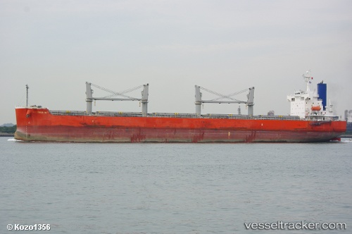
 GLOBE CLEOPATRA
Current Status
Where is the vessel?
GLOBE CLEOPATRA is currently in 395 nm S of Sao Filipe, based on AIS data received about 1h ago.
Latest AIS update:
Current position: 8.35795° N, 25.22814° W (395 nm S of Sao Filipe)
Average speed (last 7 days): Loading…
Average speed (last 30 days): Loading…
Vessel profile: GLOBE CLEOPATRA is a Bulk Carrier with dimensions 185m x 32m.
This page combines live AIS, route history, probable destination signals, nearby traffic, and port activity for practical vessel monitoring.
The current position of vessel GLOBE CLEOPATRA is 8.35795 lat / -25.22814 lng. Updated: 2026-04-19 01:41:09 UTCNearest reference points:
- Open sea, approx. 400 nm off the nearest listed port
- Open sea, approx. 401 nm off the nearest listed port
- Open sea, approx. 402 nm off the nearest listed port
Currently sailing under the flag of Marshall Islands ![]()
GLOBE CLEOPATRA built in 2009 year
Deadweight:
58765 tDetails:
Live Vessel GLOBE CLEOPATRA Analytics (details, animations, etc.)
Recent AIS points (UTC):
2026-04-18 19:44:51 UTC · 9.41333, -24.77167 · SOG 11 kn · COG -1°2026-04-18 21:48:20 UTC · 9.04786, -24.93234 · SOG 11.5 kn · COG 202°
2026-04-19 00:05:18 UTC · 8.63990, -25.10643 · SOG 11.3 kn · COG 208°
2026-04-19 01:41:09 UTC · 8.35795, -25.22814 · SOG 11.8 kn · COG 204°