 vesseltracker.com
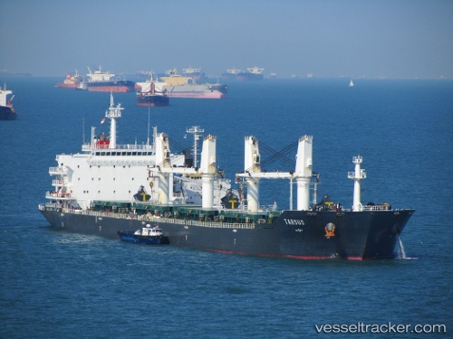
 LAGRANGE
Current Status
Where is the vessel?
LAGRANGE is currently in Near Takoradi, based on AIS data received less than 1h ago.
Latest AIS update:
Current position: 4.87080° N, 1.68182° W (Near Takoradi)
Average speed (last 7 days): Loading…
Average speed (last 30 days): Loading…
Vessel profile: LAGRANGE is a Bulk Carrier with dimensions 189m x 32m.
This page combines live AIS, route history, probable destination signals, nearby traffic, and port activity for practical vessel monitoring.
The current position of vessel LAGRANGE is 4.87080 lat / -1.68182 lng. Updated: 2026-04-13 06:02:32 UTCNearest reference points:
- Near Takoradi
- Near Sekondi
- 13 nm W of Jubilee FPSO
Currently sailing under the flag of Marshall Islands ![]()
LAGRANGE built in 2008 year
Deadweight:
53208 tDetails:
Live Vessel LAGRANGE Analytics (details, animations, etc.)
Recent AIS points (UTC):
2026-04-12 23:09:17 UTC · 4.87067, -1.68165 · SOG 0.2 kn · COG 229°2026-04-13 02:15:22 UTC · 4.87083, -1.68183 · SOG 0.5 kn · COG 223°
2026-04-13 04:12:28 UTC · 4.87066, -1.68164 · SOG 0.5 kn · COG 225°
2026-04-13 06:02:32 UTC · 4.87080, -1.68182 · SOG 0.1 kn · COG -1°