 vesseltracker.com
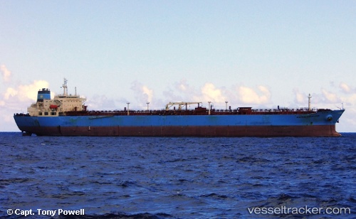
 SEA SENOR
Current Status
Where is the vessel?
SEA SENOR is currently in 58 nm SW of Cape Of Good Hope, based on AIS data received about 215d ago.
Latest AIS update:
Current position: 34.82326° S, 17.35427° E (58 nm SW of Cape Of Good Hope)
Average speed (last 7 days): Loading…
Average speed (last 30 days): Loading…
Vessel profile: SEA SENOR is a Crude Oil Tanker with dimensions 246m x 42m.
This page combines live AIS, route history, probable destination signals, nearby traffic, and port activity for practical vessel monitoring.
The current position of vessel SEA SENOR is -34.82326 lat / 17.35427 lng. Updated: 2025-09-17 17:13:47 UTCNearest reference points:
- 18 nm SW of Cape Of Good Hope
- 12 nm W of ROBBEN ISLAND
- Near HOUT BAY
Currently sailing under the flag of Marshall Islands ![]()
SEA SENOR built in 2006 year
Deadweight:
109647 tDetails:
Live Vessel SEA SENOR Analytics (details, animations, etc.)
Recent AIS points (UTC):
2025-09-17 17:13:47 UTC · -34.82326, 17.35427 · SOG 12.5 kn · COG 277°