 vesseltracker.com
 KALINKA
Current Status
Where is the vessel?
KALINKA is currently in Near Duqm, based on AIS data received about 1h ago.
Latest AIS update:
Current position: 19.66115° N, 57.71460° E (Near Duqm)
Average speed (last 7 days): Loading…
Average speed (last 30 days): Loading…
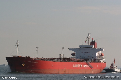
Vessel profile: KALINKA is a Oil Products Tanker with dimensions 109m x 18m.
This page combines live AIS, route history, probable destination signals, nearby traffic, and port activity for practical vessel monitoring.
The current position of vessel KALINKA is 19.66115 lat / 57.71460 lng. Updated: 2026-04-20 03:47:23 UTCNearest reference points:
- Near AL DUQM
- Near Duqm
- 39 nm SE of Pizhou
Currently sailing under the flag of Marshall Islands ![]()
KALINKA built in 2008 year
Deadweight:
47548 tDetails:
Live Vessel KALINKA Analytics (details, animations, etc.)
Recent AIS points (UTC):
2026-04-20 00:50:24 UTC · 19.66109, 57.71454 · SOG 0 kn · COG -1°2026-04-20 00:50:24 UTC · 19.66109, 57.71454 · SOG 0 kn · COG -1°
2026-04-20 03:26:22 UTC · 19.66115, 57.71458 · SOG 0 kn · COG -1°
2026-04-20 03:47:23 UTC · 19.66115, 57.71460 · SOG 0 kn · COG -1°