 vesseltracker.com
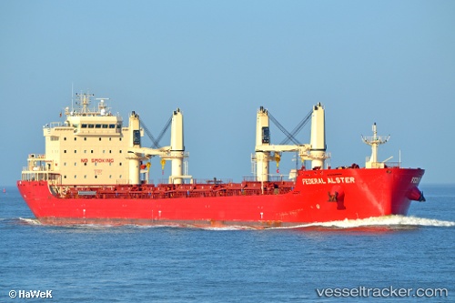
 FEDERAL ALSTER
Current Status
Where is the vessel?
FEDERAL ALSTER is currently in Near PORTO INDUSTRIALE, based on AIS data received about 12h ago.
Latest AIS update:
Current position: 41.61755° N, 15.94754° E (Near PORTO INDUSTRIALE)
Average speed (last 7 days): Loading…
Average speed (last 30 days): Loading…
Vessel profile: FEDERAL ALSTER is a Bulk Carrier with dimensions 24m x 199m.
This page combines live AIS, route history, probable destination signals, nearby traffic, and port activity for practical vessel monitoring.
The current position of vessel FEDERAL ALSTER is 41.61755 lat / 15.94754 lng. Updated: 2026-04-10 07:18:39 UTCNearest reference points:
- Near TERMOLI
- 26 nm N of Isole Tremiti
- Near Salerno
Currently sailing under the flag of Marshall Islands ![]()
FEDERAL ALSTER built in 2016 year
Deadweight:
36583 tDetails:
Live Vessel FEDERAL ALSTER Analytics (details, animations, etc.)
Recent AIS points (UTC):
2026-04-10 02:24:17 UTC · 41.61667, 15.94667 · SOG 0 kn · COG -1°2026-04-10 03:45:17 UTC · 41.61667, 15.94667 · SOG 0 kn · COG -1°
2026-04-10 05:36:19 UTC · 41.61752, 15.94751 · SOG 0 kn · COG 337°
2026-04-10 07:18:39 UTC · 41.61755, 15.94754 · SOG 0 kn · COG 336°