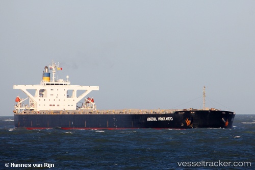
.
Vessel photo of IMPERIAL FORTUNE (IMO 9384954) vesseltracker.com

MH flag IMPERIAL FORTUNE

Vessel type: Bulk Carrier | IMO: 9384954 | MMSI: MMSI: 538008929
Call sign: V7A2916 | Dimensions: 289 m x 45 m
Current Status

Where is the vessel?

IMPERIAL FORTUNE is currently in Near Daxie Pt, based on AIS data received about 2h ago.

Latest AIS update:

Current position: 29.77657° N, 122.06852° E (Near Daxie Pt)

Average speed (last 7 days): Loading…

Average speed (last 30 days): Loading…

Vessel profile: IMPERIAL FORTUNE is a Bulk Carrier with dimensions 289m x 45m.

This page combines live AIS, route history, probable destination signals, nearby traffic, and port activity for practical vessel monitoring.

The current position of vessel IMPERIAL FORTUNE is 29.77657 lat / 122.06852 lng. Updated: 2026-04-09 11:26:53 UTC
Nearest reference points:
  • Near Daxie Pt
  • 10 nm SE of Daxie Pt
  • 11 nm S of Daxie Pt

Currently sailing under the flag of Marshall Islands MH flag

IMPERIAL FORTUNE built in 2008 year

Deadweight:
180159 t

Details:

Live Vessel IMPERIAL FORTUNE Analytics (details, animations, etc.)


Recent AIS points (UTC):
2026-04-09 06:17:50 UTC · 29.77672, 122.06847 · SOG 0 kn · COG 45°
2026-04-09 08:17:51 UTC · 29.77675, 122.06852 · SOG 0 kn · COG 45°
2026-04-09 10:20:50 UTC · 29.77675, 122.06843 · SOG 0.1 kn · COG 45°
2026-04-09 11:26:53 UTC · 29.77657, 122.06852 · SOG 0 kn · COG 45°

Track of the vessel in the last 60 days


UTC: --
Start: -- Track timeline (UTC) End: --
Encountered: --


Link to the map:


Find another ship

IMPERIAL_FORTUNE (538008929) last ports (portcalls and passsages)

Caofeidian Pt | 2025-09-08 11:05:17
Tsugaru-Kaikyo | 2025-06-13 22:59:35
JINGTANG | 2025-06-06 02:58:33
TANAH MERAH | 2025-05-26 16:56:31
BUKOM ISLAND | 2025-05-26 15:49:09
Richards Bay | 2025-05-07 20:48:57
Richards Bay | 2025-04-27 19:50:14
PULAU SAMBU | 2025-04-10 20:12:43
PENGERANG | 2025-04-10 18:13:29
ZHOUSHAN | 2025-04-02 05:18:11
Selat Lombok | 2025-03-12 18:00:56
Dampier | 2025-03-08 08:32:23
PENGERANG | 2025-01-20 05:02:28
TANAH MERAH | 2025-01-20 04:10:15
BATU AMPAR | 2025-01-20 02:23:26
PULAU SAMBU | 2025-01-20 01:33:52
BUKOM ISLAND | 2025-01-20 00:26:29
PANGKOR | 2025-01-16 04:35:43
PULAU SAMBU | 2025-01-14 07:44:45
BATU AMPAR | 2025-01-14 07:07:49
TANAH MERAH | 2025-01-14 06:26:45
Fangcheng | 2025-01-06 04:26:05
TANAH MERAH | 2024-12-27 22:45:27
BATU AMPAR | 2024-12-27 22:18:21
BUKOM ISLAND | 2024-12-27 20:49:28
SALDANHA | 2024-12-02 00:20:56
Saldanha Bay | 2024-12-01 23:25:10
PULAU SAMBU | 2024-11-10 16:45:56
BATU AMPAR | 2024-11-10 15:01:05
PENGERANG | 2024-11-09 16:55:07
Panjang | 2024-10-08 06:40:18
Singapore | 2024-07-25 19:16:19
Selat Lombok | 2024-07-04 20:10:39
Port Headland | 2024-07-01 06:02:29
Selat Lombok | 2024-06-25 01:14:24
Wusong | 2024-06-15 12:08:50
Nantong | 2024-06-13 04:08:02
Taicang | 2024-06-13 00:48:01
Jingjiang | 2024-06-12 03:05:19
Rizhao | 2024-06-09 12:27:57
Port Headland | 2024-05-25 05:50:33
San Nicolas | 2024-03-23 20:48:12
San Nicolas | 2024-03-19 19:49:10
San Nicolas | 2024-03-11 18:16:45
San Nicolas | 2024-03-07 15:58:12
Strait Of Gibraltar | 2023-10-21 17:16:44
Algeciras | 2023-10-20 19:10:30
Alexandria | 2023-10-10 04:06:30
Strait Of Gibraltar | 2023-10-03 14:27:54
Vitoria | 2023-09-17 16:24:07
Tubarao | 2023-09-16 13:34:25
Tubarao | 2023-09-08 05:54:19
Port Elizabeth | 2023-08-26 15:06:34
Sebang | 2023-08-07 16:21:34
Singapore | 2023-08-05 08:21:05
Newcastle | 2023-07-05 02:22:21
Wakamatsu | 2023-06-15 07:34:00
Yokohama | 2023-06-08 08:27:14
Yokosuka | 2023-06-06 19:38:51
Samson Point | 2023-05-21 15:48:21
Selat Lombok | 2023-04-10 06:49:38
Port Headland | 2023-04-06 07:16:42
Singapore | 2023-01-15 23:31:13