 vesseltracker.com
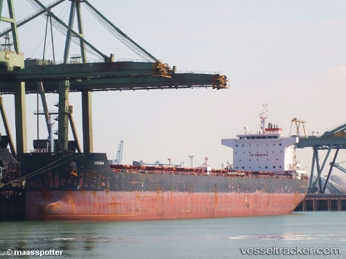
 SUNRISE I
Current Status
Where is the vessel?
SUNRISE I is currently in 130 nm NW of Burnopfield, based on AIS data received less than 1h ago.
Latest AIS update:
Current position: 55.88883° N, 174.36937° W (130 nm NW of Burnopfield)
Average speed (last 7 days): Loading…
Average speed (last 30 days): Loading…
Vessel profile: SUNRISE I is a Bulk Carrier with dimensions 32m x 229m.
This page combines live AIS, route history, probable destination signals, nearby traffic, and port activity for practical vessel monitoring.
The current position of vessel SUNRISE I is 55.88883 lat / -174.36937 lng. Updated: 2026-04-21 04:09:44 UTCCurrently sailing under the flag of Marshall Islands ![]()
SUNRISE I built in 2010 year
Deadweight:
80370 tDetails:
Live Vessel SUNRISE I Analytics (details, animations, etc.)
Recent AIS points (UTC):
2026-04-21 01:03:15 UTC · 56.27404, -173.79529 · SOG 9.8 kn · COG 217°2026-04-21 01:45:49 UTC · 56.18229, -173.91463 · SOG 9.8 kn · COG 218°
2026-04-21 04:03:19 UTC · 55.90035, -174.34875 · SOG 9.8 kn · COG 221°
2026-04-21 04:09:44 UTC · 55.88883, -174.36937 · SOG 9.7 kn · COG 220°