 vesseltracker.com
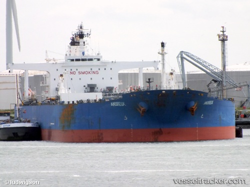
 RIDGEBURY MARY JANE
Current Status
Where is the vessel?
RIDGEBURY MARY JANE is currently in 76 nm E of Bernard, based on AIS data received about 618d ago.
Latest AIS update:
Current position: 69.15703° N, 111.42611° W (76 nm E of Bernard)
Average speed (last 7 days): Loading…
Average speed (last 30 days): Loading…
Vessel profile: RIDGEBURY MARY JANE is a Crude Oil Tanker with dimensions 273m x 48m.
This page combines live AIS, route history, probable destination signals, nearby traffic, and port activity for practical vessel monitoring.
The current position of vessel RIDGEBURY MARY JANE is 69.15703 lat / -111.42611 lng. Updated: 2024-08-11 13:09:09 UTCCurrently sailing under the flag of Marshall Islands ![]()
RIDGEBURY MARY JANE built in 2008 year
Deadweight:
149993 tDetails:
Live Vessel RIDGEBURY MARY JANE Analytics (details, animations, etc.)
Recent AIS points (UTC):
2024-08-11 13:09:09 UTC · 69.15703, -111.42611 · SOG 44.7 kn · COG 121°