.
Vessel photo of YASA SOUTHERN CROSS (IMO 9534030) vesseltracker.com

MH flag YASA SOUTHERN CROSS

Vessel type: Crude Oil Tanker | IMO: 9534030 | MMSI: MMSI: 538009409
Call sign: V7A4697 | Dimensions: 333 m x 60 m
Current Status

Where is the vessel?

YASA SOUTHERN CROSS is currently in 98 nm S of Nagercoil, based on AIS data received less than 1h ago.

Latest AIS update:

Current position: 6.63677° N, 78.01548° E (98 nm S of Nagercoil)

Average speed (last 7 days): Loading…

Average speed (last 30 days): Loading…

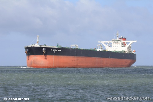
Vessel profile: YASA SOUTHERN CROSS is a Crude Oil Tanker with dimensions 333m x 60m.

This page combines live AIS, route history, probable destination signals, nearby traffic, and port activity for practical vessel monitoring.

The current position of vessel YASA SOUTHERN CROSS is 6.63677 lat / 78.01548 lng. Updated: 2026-04-18 10:10:30 UTC
Nearest reference points:
  • 94 nm W of Dehiwala
  • 98 nm S of Nagercoil
  • 90 nm W of Moratuwa

Currently sailing under the flag of Marshall Islands MH flag

YASA SOUTHERN CROSS built in 2012 year

Deadweight:
318348 t

Details:

Live Vessel YASA SOUTHERN CROSS Analytics (details, animations, etc.)


Recent AIS points (UTC):
2026-04-18 04:07:58 UTC · 6.07230, 79.22719 · SOG 13.3 kn · COG -1°
2026-04-18 05:37:36 UTC · 6.20268, 78.92675 · SOG 13.2 kn · COG -1°
2026-04-18 08:00:29 UTC · 6.42273, 78.45743 · SOG 13.3 kn · COG -1°
2026-04-18 10:10:30 UTC · 6.63677, 78.01548 · SOG 13.3 kn · COG -1°

Track of the vessel in the last 60 days


UTC: --
Start: -- Track timeline (UTC) End: --
Encountered: --


Link to the map:


Find another ship

YASA_SOUTHERN_CROSS (538009409) last ports (portcalls and passsages)

Kaohsiung | 2025-08-31 03:24:56
PENGERANG | 2025-08-25 14:38:56
TANAH MERAH | 2025-08-25 05:28:37
BUKOM ISLAND | 2025-08-25 03:48:48
ARANSAS PASS | 2025-06-30 22:19:07
PEMBROKE | 2025-06-14 18:49:04
PEMBROKE | 2025-06-10 18:08:18
BRIELLE | 2025-06-06 09:25:53
Kole | 2025-05-13 21:18:36
PULAU SAMBU | 2025-03-25 11:40:51
PULAU SAMBU | 2025-03-21 10:42:29
BUKOM ISLAND | 2025-03-17 12:51:58
JURONG ISLAND | 2025-03-17 12:21:21
PULAU SAMBU | 2025-03-17 09:28:08
TANAH MERAH | 2025-03-17 08:25:19
PENGERANG | 2025-03-17 06:23:48
SURALAYA | 2025-03-13 20:43:57
BAKAUHENI | 2025-03-13 19:26:06
ARANSAS PASS | 2025-01-12 18:23:05
Freeport | 2024-12-27 12:27:08
SAINT MAWES | 2024-12-03 13:45:57
HONFLEUR AVANT-PORT | 2024-11-28 20:57:27
BRIELLE | 2024-11-21 21:14:20
HOEK VAN HOLLAND | 2024-11-21 20:06:53
Southampton | 2024-10-01 11:22:19
Portsmouth | 2024-10-01 08:46:58
Fujairah | 2024-08-10 17:49:57
Sambu | 2024-07-17 15:42:17
Singapore | 2024-06-23 06:17:56
Loop Terminal | 2024-04-29 18:54:52
Freeport | 2024-04-26 17:41:37
Maassluis | 2024-04-09 03:17:18
Puerto De La Luz | 2024-04-02 23:27:02
Singapore | 2024-02-06 15:16:55
Incheon | 2024-01-27 08:58:58
Ulsan | 2024-01-17 03:59:29
Honfleur | 2023-10-28 21:11:10
Le Harve | 2023-10-28 20:05:37
Southampton | 2023-10-25 19:45:53
Cowes | 2023-10-25 18:57:10
Portsmouth | 2023-10-25 18:03:57
Southampton | 2023-09-10 19:19:03
Cowes | 2023-09-10 18:25:58
Vlaardingen | 2023-09-08 10:28:59
Maassluis | 2023-09-05 22:10:28
Dover | 2023-07-21 20:38:30
Maassluis | 2023-07-18 02:39:42
Maassluis | 2023-07-14 02:15:27
Southampton | 2023-05-30 07:00:41
Portsmouth | 2023-05-30 05:30:53
Southampton | 2023-05-24 00:51:43
Cowes | 2023-05-24 00:19:48
Dover | 2023-05-23 03:31:10
Maassluis | 2023-05-21 14:26:59
Maassluis | 2023-04-03 01:04:04
Singapore | 2023-01-09 20:21:45