 vesseltracker.com
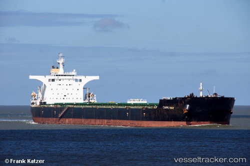
 CAPE RAY
Current Status
Where is the vessel?
CAPE RAY is currently in 49 nm SE of Abakaliki, based on AIS data received about 3h ago.
Latest AIS update:
Current position: 5.83167° N, 86.63833° E (49 nm SE of Abakaliki)
Average speed (last 7 days): Loading…
Average speed (last 30 days): Loading…
Vessel profile: CAPE RAY is a Bulk Carrier with dimensions 292m x 45m.
This page combines live AIS, route history, probable destination signals, nearby traffic, and port activity for practical vessel monitoring.
The current position of vessel CAPE RAY is 5.83167 lat / 86.63833 lng. Updated: 2026-04-05 04:28:38 UTCNearest reference points:
- 23 nm S of Abakaliki
- 46 nm SW of Abakaliki
Currently sailing under the flag of Marshall Islands ![]()
CAPE RAY built in 2007 year
Deadweight:
177853 tDetails:
Live Vessel CAPE RAY Analytics (details, animations, etc.)
Recent AIS points (UTC):
2026-04-04 22:55:42 UTC · 5.80833, 85.68833 · SOG 10 kn · COG -1°2026-04-05 00:40:36 UTC · 5.81833, 85.99166 · SOG 10 kn · COG -1°
2026-04-05 02:22:34 UTC · 5.82500, 86.28833 · SOG 10 kn · COG -1°
2026-04-05 04:28:38 UTC · 5.83167, 86.63833 · SOG 10 kn · COG -1°