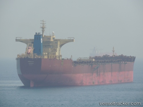
.
Vessel photo of VOLTA (IMO 9587362) vesseltracker.com

MH flag VOLTA

Vessel type: Bulk Carrier | IMO: 9587362 | MMSI: MMSI: 538009567
Call sign: V7A4900 | Dimensions: 45 m x 292 m
Current Status

Where is the vessel?

VOLTA is currently in 83 nm NW of Ile Desroches, based on AIS data received about 1d ago.

Latest AIS update:

Current position: 5.00500° S, 52.46667° E (83 nm NW of Ile Desroches)

Average speed (last 7 days): Loading…

Average speed (last 30 days): Loading…

Vessel profile: VOLTA is a Bulk Carrier with dimensions 45m x 292m.

This page combines live AIS, route history, probable destination signals, nearby traffic, and port activity for practical vessel monitoring.

The current position of vessel VOLTA is -5.00500 lat / 52.46667 lng. Updated: 2026-04-10 07:04:49 UTC
Nearest reference points:
  • Near Ile Desroches
  • 118 nm W of Ile Desroches
  • 219 nm W of Ile Desroches

Currently sailing under the flag of Marshall Islands MH flag

VOLTA built in 2010 year

Deadweight:
177066 t

Details:

Live Vessel VOLTA Analytics (details, animations, etc.)


Recent AIS points (UTC):
2026-04-10 02:31:49 UTC · -4.23333, 52.97167 · SOG 12 kn · COG -1°
2026-04-10 03:55:50 UTC · -4.46833, 52.81500 · SOG 12 kn · COG -1°
2026-04-10 06:07:47 UTC · -4.84667, 52.57167 · SOG 12 kn · COG -1°
2026-04-10 07:04:49 UTC · -5.00500, 52.46667 · SOG 11 kn · COG -1°

Track of the vessel in the last 60 days


UTC: --
Start: -- Track timeline (UTC) End: --
Encountered: --


Link to the map:


Find another ship

VOLTA (538009567) last ports (portcalls and passsages)

AL JUBAIL | 2025-09-08 08:49:46
KHALIFA BIN SALMAN | 2025-08-25 09:20:00
MUHARRAQ | 2025-08-22 20:39:21
SITRAH | 2025-08-22 19:45:22
KHALIFA BIN SALMAN | 2025-08-21 09:19:27
AL JUBAIL | 2025-06-10 22:30:06
Jubail | 2025-06-06 23:24:31
AL JUBAIL | 2025-06-06 22:23:06
Narvik | 2025-04-06 03:52:50
LOEDINGEN | 2025-04-06 00:42:20
TARIFA | 2025-03-27 04:16:04
CARTEYA GUADARRANQUE | 2025-03-26 10:49:34
Algeciras | 2025-03-26 06:39:36
MISURATA | 2025-03-18 17:22:43
MISURATA | 2025-03-14 16:23:26
MISURATA | 2025-03-10 16:05:39
TARIFA | 2025-03-05 20:59:51
JURONG ISLAND | 2025-01-12 03:29:01
BUKOM ISLAND | 2025-01-12 02:55:10
BATU AMPAR | 2025-01-08 03:36:59
TANAH MERAH | 2025-01-08 02:43:43
PENGERANG | 2025-01-08 01:36:44
Bayuquan | 2024-12-27 16:59:21
Selat Lombok | 2024-12-11 04:05:36
PORT WALCOTT | 2024-12-07 03:00:58
Samson Point | 2024-12-07 01:26:50
Port Louis | 2024-10-10 10:31:27
Qingdao | 2024-07-22 00:37:47
Qingdao | 2024-07-18 00:13:35
Sebang | 2024-06-28 14:34:48
Port Elizabeth | 2024-05-08 15:51:00
Richards Bay | 2024-03-19 19:29:12
Singapore | 2024-02-28 12:14:21
Samson Point | 2024-01-19 13:26:47
Samson Point | 2024-01-15 05:55:47
Sambu | 2023-12-07 02:05:07
Ra’S Shukhayr | 2023-11-17 07:59:06
Ras Gharib | 2023-11-17 06:25:58
Ayn Sukhnah | 2023-11-16 22:56:53
Bur Ibrahim | 2023-11-16 21:10:52
Port Said | 2023-11-16 10:52:12
Algeciras | 2023-11-05 04:46:19
Strait Of Gibraltar | 2023-11-04 21:03:43
Port Etienne | 2023-10-29 13:21:51
Nouadhibou | 2023-10-25 18:04:57
Port Etienne | 2023-10-14 18:07:23
Conakry | 2023-08-08 09:07:43
Sitrah Anchorage | 2023-07-03 16:50:52
Singapore | 2023-04-23 06:59:10
Cape Of Good Hope | 2023-03-06 11:44:36
Saldanha Bay | 2023-03-03 14:48:28
Sitrah Anchorage | 2023-02-05 11:17:08
Sitrah Anchorage | 2023-02-01 11:11:03