 vesseltracker.com
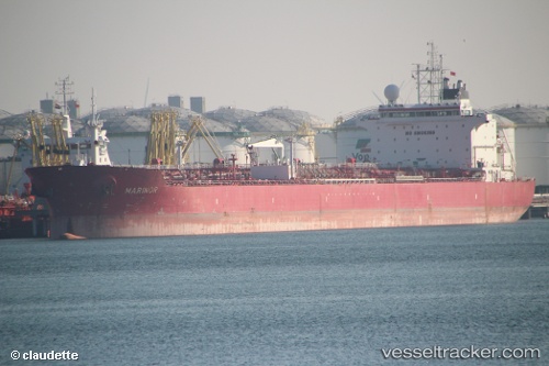
 SUNNY LIGER
Current Status
Where is the vessel?
SUNNY LIGER is currently in Open sea, approx. 406 nm off the nearest listed port, based on AIS data received less than 1h ago.
Latest AIS update:
Current position: 9.87084° S, 25.19631° W (Open sea, approx. 406 nm off the nearest listed port)
Average speed (last 7 days): Loading…
Average speed (last 30 days): Loading…
Vessel profile: SUNNY LIGER is a Oil Products Tanker with dimensions 229m x 31m.
This page combines live AIS, route history, probable destination signals, nearby traffic, and port activity for practical vessel monitoring.
The current position of vessel SUNNY LIGER is -9.87084 lat / -25.19631 lng. Updated: 2026-04-18 00:05:29 UTCNearest reference points:
- Open sea, approx. 406 nm off the nearest listed port
- Open sea, approx. 408 nm off the nearest listed port
- Open sea, approx. 415 nm off the nearest listed port
Currently sailing under the flag of Marshall Islands ![]()
SUNNY LIGER built in 2008 year
Deadweight:
74997 tDetails:
Live Vessel SUNNY LIGER Analytics (details, animations, etc.)
Recent AIS points (UTC):
2026-04-17 18:10:28 UTC · -10.65268, -24.15036 · SOG 12.8 kn · COG 314°2026-04-17 20:28:09 UTC · -10.34144, -24.54596 · SOG 13.1 kn · COG 308°
2026-04-17 21:27:18 UTC · -10.21621, -24.72759 · SOG 13.2 kn · COG 307°
2026-04-18 00:05:29 UTC · -9.87084, -25.19631 · SOG 13.1 kn · COG 310°