 vesseltracker.com
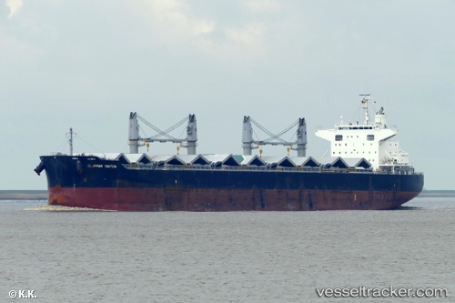
 DARYA ANITA
Current Status
Where is the vessel?
DARYA ANITA is currently in 45 nm NE of KIJANG, based on AIS data received less than 1h ago.
Latest AIS update:
Current position: 1.39443° N, 105.13690° E (45 nm NE of KIJANG)
Average speed (last 7 days): Loading…
Average speed (last 30 days): Loading…
Vessel profile: DARYA ANITA is a Bulk Carrier with dimensions 32m x 200m.
This page combines live AIS, route history, probable destination signals, nearby traffic, and port activity for practical vessel monitoring.
The current position of vessel DARYA ANITA is 1.39443 lat / 105.13690 lng. Updated: 2026-04-18 09:42:02 UTCNearest reference points:
- 47 nm NE of PENGERANG
- 38 nm E of PENGERANG
- 34 nm NE of PENGERANG
Currently sailing under the flag of Marshall Islands ![]()
DARYA ANITA built in 2013 year
Deadweight:
61448 tDetails:
Live Vessel DARYA ANITA Analytics (details, animations, etc.)
Recent AIS points (UTC):
2026-04-18 03:29:37 UTC · 0.66833, 105.91500 · SOG 10 kn · COG -1°2026-04-18 06:08:45 UTC · 0.99500, 105.59667 · SOG 10 kn · COG -1°
2026-04-18 07:44:39 UTC · 1.19167, 105.40667 · SOG 10 kn · COG -1°
2026-04-18 09:42:02 UTC · 1.39443, 105.13690 · SOG 10.3 kn · COG -1°