 vesseltracker.com
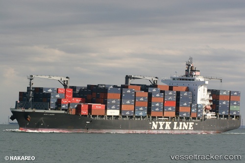
 NYK LAURA
Current Status
Where is the vessel?
NYK LAURA is currently in Near Corinto, based on AIS data received less than 1h ago.
Latest AIS update:
Current position: 12.47616° N, 87.21660° W (Near Corinto)
Average speed (last 7 days): Loading…
Average speed (last 30 days): Loading…
Vessel profile: NYK LAURA is a Container Ship with dimensions 210m x 30m.
This page combines live AIS, route history, probable destination signals, nearby traffic, and port activity for practical vessel monitoring.
The current position of vessel NYK LAURA is 12.47616 lat / -87.21660 lng. Updated: 2026-04-01 23:50:23 UTCNearest reference points:
- Near El Salvador
- 27 nm W of Playa Conchal
- Near Golfo de Papagayo
Currently sailing under the flag of Marshall Islands ![]()
NYK LAURA built in 2009 year
Deadweight:
34576 tDetails:
Live Vessel NYK LAURA Analytics (details, animations, etc.)
Recent AIS points (UTC):
2026-04-01 18:17:57 UTC · 12.48190, -87.16773 · SOG 0 kn · COG 23°2026-04-01 19:56:57 UTC · 12.48167, -87.16667 · SOG 0 kn · COG -1°
2026-04-01 21:41:56 UTC · 12.48203, -87.16768 · SOG 0 kn · COG 23°
2026-04-01 23:50:23 UTC · 12.47616, -87.21660 · SOG 7 kn · COG 258°