 vesseltracker.com
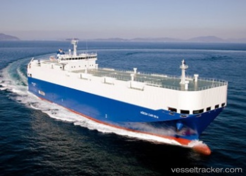
 HOEGH CARIBIA
Current Status
Where is the vessel?
HOEGH CARIBIA is currently in 12 nm W of Terre-de-Bas, based on AIS data received about 1h ago.
Latest AIS update:
Current position: 15.78151° N, 61.83717° W (12 nm W of Terre-de-Bas)
Average speed (last 7 days): Loading…
Average speed (last 30 days): Loading…
Vessel profile: HOEGH CARIBIA is a Vehicles Carrier with dimensions 140m x 22m.
This page combines live AIS, route history, probable destination signals, nearby traffic, and port activity for practical vessel monitoring.
The current position of vessel HOEGH CARIBIA is 15.78151 lat / -61.83717 lng. Updated: 2026-04-20 02:10:50 UTCNearest reference points:
- Near Pointe A Pitre
- Near Le Gosier
- Near ANTIGUA
Currently sailing under the flag of Marshall Islands ![]()
HOEGH CARIBIA built in 2010 year
Deadweight:
5493 tDetails:
Live Vessel HOEGH CARIBIA Analytics (details, animations, etc.)
Recent AIS points (UTC):
2026-04-19 23:03:49 UTC · 15.75592, -61.73452 · SOG 1.8 kn · COG 7°2026-04-19 23:30:08 UTC · 15.75903, -61.74702 · SOG 1.8 kn · COG 5°
2026-04-20 01:23:49 UTC · 15.77296, -61.81029 · SOG 2.2 kn · COG 1°
2026-04-20 02:10:50 UTC · 15.78151, -61.83717 · SOG 2.2 kn · COG 7°