 vesseltracker.com
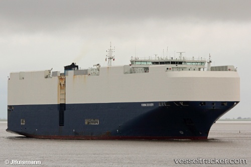
 VIKING BRAVERY
Current Status
Where is the vessel?
VIKING BRAVERY is currently in 136 nm SW of Bubaque, based on AIS data received about 2h ago.
Latest AIS update:
Current position: 9.20967° N, 16.74384° W (136 nm SW of Bubaque)
Average speed (last 7 days): Loading…
Average speed (last 30 days): Loading…
Vessel profile: VIKING BRAVERY is a Vehicles Carrier with dimensions 199m x 199m.
This page combines live AIS, route history, probable destination signals, nearby traffic, and port activity for practical vessel monitoring.
The current position of vessel VIKING BRAVERY is 9.20967 lat / -16.74384 lng. Updated: 2026-04-08 19:55:18 UTCNearest reference points:
- 97 nm SW of Port de Boké
- 144 nm SW of Bubaque
- 79 nm SW of Conakry
Currently sailing under the flag of Marshall Islands ![]()
VIKING BRAVERY built in 2015 year
Deadweight:
18946 tDetails:
Live Vessel VIKING BRAVERY Analytics (details, animations, etc.)
Recent AIS points (UTC):
2026-04-08 14:09:10 UTC · 7.97744, -15.87379 · SOG 15.3 kn · COG 325°2026-04-08 16:10:04 UTC · 8.41399, -16.17308 · SOG 15.8 kn · COG 324°
2026-04-08 17:37:08 UTC · 8.72328, -16.39896 · SOG 15.4 kn · COG 327°
2026-04-08 19:55:18 UTC · 9.20967, -16.74384 · SOG 15.5 kn · COG 327°