 vesseltracker.com
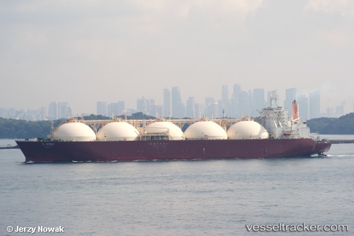
 AL WAKRAH
Current Status
Where is the vessel?
AL WAKRAH is currently in 109 nm SW of Keti Bandar, based on AIS data received about 1h ago.
Latest AIS update:
Current position: 22.61967° N, 66.33348° E (109 nm SW of Keti Bandar)
Average speed (last 7 days): Loading…
Average speed (last 30 days): Loading…
Vessel profile: AL WAKRAH is a LNG Tanker with dimensions 298m x 46m.
This page combines live AIS, route history, probable destination signals, nearby traffic, and port activity for practical vessel monitoring.
The current position of vessel AL WAKRAH is 22.61967 lat / 66.33348 lng. Updated: 2026-04-18 23:36:15 UTCNearest reference points:
- 84 nm SW of Keti Bandar
- 16 nm S of Kiamari
- 231 nm SW of Keti Bandar
Currently sailing under the flag of Marshall Islands ![]()
AL WAKRAH built in 1998 year
Deadweight:
72453 tDetails:
Live Vessel AL WAKRAH Analytics (details, animations, etc.)
Recent AIS points (UTC):
2026-04-18 18:07:05 UTC · 22.57326, 66.31244 · SOG 0.3 kn · COG 158°2026-04-18 19:35:56 UTC · 22.58027, 66.31936 · SOG 0.4 kn · COG 156°
2026-04-18 22:07:55 UTC · 22.60456, 66.32897 · SOG 0.6 kn · COG 187°
2026-04-18 23:36:15 UTC · 22.61967, 66.33348 · SOG 0.6 kn · COG 182°