 vesseltracker.com
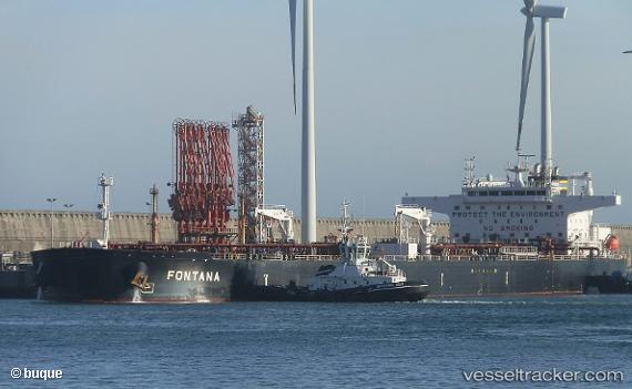
 FONTANA
Current Status
Where is the vessel?
FONTANA is currently in Near Carro, based on AIS data received less than 1h ago.
Latest AIS update:
Current position: 43.34850° N, 5.00047° E (Near Carro)
Average speed (last 7 days): Loading…
Average speed (last 30 days): Loading…
Vessel profile: FONTANA is a Crude Oil Tanker with dimensions 274m x 48m.
This page combines live AIS, route history, probable destination signals, nearby traffic, and port activity for practical vessel monitoring.
The current position of vessel FONTANA is 43.34850 lat / 5.00047 lng. Updated: 2026-04-14 21:32:35 UTCNearest reference points:
- Near Fos-sur-Mer
- Near SAINT LOUIS DU RHONE
- Near Marseille
Currently sailing under the flag of Marshall Islands ![]()
FONTANA built in 2017 year
Deadweight:
159541 tDetails:
Live Vessel FONTANA Analytics (details, animations, etc.)
Recent AIS points (UTC):
2026-04-14 15:47:35 UTC · 43.34851, 5.00030 · SOG 0 kn · COG 331°2026-04-14 17:41:34 UTC · 43.34826, 5.00006 · SOG 0 kn · COG 337°
2026-04-14 20:14:33 UTC · 43.34842, 5.00044 · SOG 0 kn · COG 330°
2026-04-14 21:32:35 UTC · 43.34850, 5.00047 · SOG 0 kn · COG 329°