 vesseltracker.com
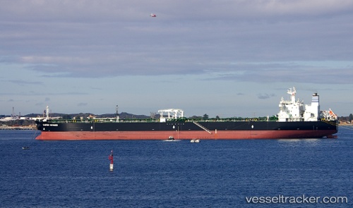
 LAMBADA
Current Status
Where is the vessel?
LAMBADA is currently in 21 nm SW of Santa Maria, based on AIS data received about 216d ago.
Latest AIS update:
Current position: 20.96224° N, 78.72532° W (21 nm SW of Santa Maria)
Average speed (last 7 days): Loading…
Average speed (last 30 days): Loading…
Vessel profile: LAMBADA is a Crude Oil Tanker with dimensions 244m x 42m.
This page combines live AIS, route history, probable destination signals, nearby traffic, and port activity for practical vessel monitoring.
The current position of vessel LAMBADA is 20.96224 lat / -78.72532 lng. Updated: 2025-08-24 10:37:05 UTCNearest reference points:
- 36 nm E of Cayo Coco
- 16 nm SE of Ceiba Hueca
- 28 nm NE of VARADERO
Currently sailing under the flag of Marshall Islands ![]()
LAMBADA built in 2006 year
Deadweight:
104866 tDetails:
Live Vessel LAMBADA Analytics (details, animations, etc.)
Recent AIS points (UTC):
2025-08-24 10:37:05 UTC · 20.96224, -78.72532 · SOG 0.3 kn · COG 69°