 vesseltracker.com
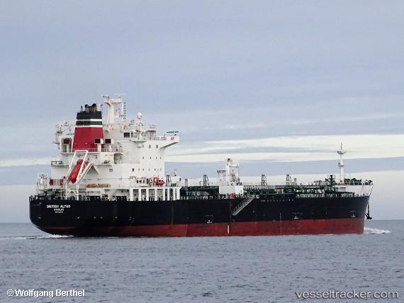
 SEA ALTUS
Current Status
Where is the vessel?
SEA ALTUS is currently in 26 nm NE of Boboras, based on AIS data received about 3h ago.
Latest AIS update:
Current position: 46.69267° N, 7.63635° W (26 nm NE of Boboras)
Average speed (last 7 days): Loading…
Average speed (last 30 days): Loading…
Vessel profile: SEA ALTUS is a Chemical/Oil Products Tanker with dimensions 183m x 32m.
This page combines live AIS, route history, probable destination signals, nearby traffic, and port activity for practical vessel monitoring.
The current position of vessel SEA ALTUS is 46.69267 lat / -7.63635 lng. Updated: 2026-04-18 04:00:03 UTCNearest reference points:
- 58 nm SE of Rietheim-Weilheim
- 57 nm S of Boboras
- 60 nm SE of San Clodio
Currently sailing under the flag of Marshall Islands ![]()
SEA ALTUS built in 2017 year
Deadweight:
39999 tDetails:
Live Vessel SEA ALTUS Analytics (details, animations, etc.)
Recent AIS points (UTC):
2026-04-17 23:24:11 UTC · 47.39465, -7.05183 · SOG 10.4 kn · COG 204°2026-04-18 01:13:36 UTC · 47.11946, -7.27548 · SOG 10.1 kn · COG -1°
2026-04-18 02:23:43 UTC · 46.95257, -7.42125 · SOG 10.5 kn · COG -1°
2026-04-18 04:00:03 UTC · 46.69267, -7.63635 · SOG 10.9 kn · COG 207°