 PREMIERSHIP
Current Status
Where is the vessel?
PREMIERSHIP is currently in Open sea (no nearby ports in database), based on AIS data received about 14h ago.
Latest AIS update:
Current position: 6.94449° S, 3.61100° W (Open sea (no nearby ports in database))
Average speed (last 7 days): Loading…
Average speed (last 30 days): Loading…
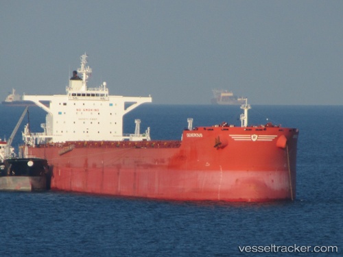
Vessel profile: PREMIERSHIP is a Bulk Carrier with dimensions m x m.
This page combines live AIS, route history, probable destination signals, nearby traffic, and port activity for practical vessel monitoring.
The current position of vessel PREMIERSHIP is -6.94449 lat / -3.61100 lng. Updated: 2026-05-24 00:22:51 UTCNearest reference points:
- Open sea (no nearby ports in database)
Currently sailing under the flag of Marshall Islands ![]()
Details:
Live Vessel PREMIERSHIP Analytics (details, animations, etc.)
Recent AIS points (UTC):
2026-05-23 19:57:50 UTC · -7.59725, -3.11400 · SOG 11 kn · COG 324°2026-05-23 22:09:52 UTC · -7.27043, -3.35855 · SOG 11 kn · COG 323°
2026-05-23 22:19:02 UTC · -7.24801, -3.37612 · SOG 11.1 kn · COG 323°
2026-05-24 00:22:51 UTC · -6.94449, -3.61100 · SOG 10.9 kn · COG 322°