 vesseltracker.com
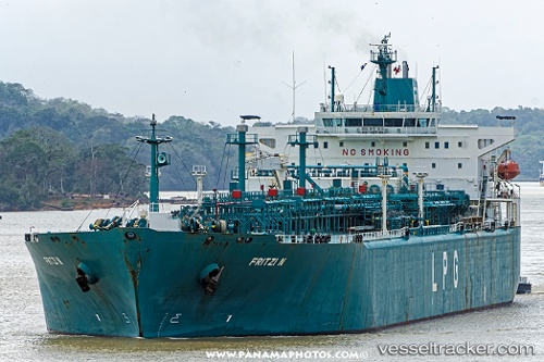
 FRITZI N
Current Status
Where is the vessel?
FRITZI N is currently in Open sea (no nearby ports in database), based on AIS data received less than 1h ago.
Latest AIS update:
Current position: 18.71961° S, 15.23244° W (Open sea (no nearby ports in database))
Average speed (last 7 days): Loading…
Average speed (last 30 days): Loading…
Vessel profile: FRITZI N is a Lpg Tanker with dimensions m x m.
This page combines live AIS, route history, probable destination signals, nearby traffic, and port activity for practical vessel monitoring.
The current position of vessel FRITZI N is -18.71961 lat / -15.23244 lng. Updated: 2026-04-13 13:45:32 UTCNearest reference points:
- Open sea (no nearby ports in database)
Currently sailing under the flag of Marshall Islands ![]()
Details:
Live Vessel FRITZI N Analytics (details, animations, etc.)
Recent AIS points (UTC):
2026-04-13 08:24:04 UTC · -19.46154, -14.09888 · SOG 15.1 kn · COG 319°2026-04-13 10:05:06 UTC · -19.27341, -14.48625 · SOG 15.2 kn · COG 295°
2026-04-13 11:58:28 UTC · -18.98221, -14.86690 · SOG 15.1 kn · COG 324°
2026-04-13 13:45:32 UTC · -18.71961, -15.23244 · SOG 15.2 kn · COG 324°