 vesseltracker.com
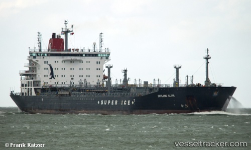
 ROYAL JASMINE
Current Status
Where is the vessel?
ROYAL JASMINE is currently in Near BUKOM ISLAND, based on AIS data received about 1h ago.
Latest AIS update:
Current position: 1.23859° N, 103.74010° E (Near BUKOM ISLAND)
Average speed (last 7 days): Loading…
Average speed (last 30 days): Loading…
Vessel profile: ROYAL JASMINE is a Oil/Chemical Tanker with dimensions m x m.
This page combines live AIS, route history, probable destination signals, nearby traffic, and port activity for practical vessel monitoring.
The current position of vessel ROYAL JASMINE is 1.23859 lat / 103.74010 lng. Updated: 2026-04-12 10:02:31 UTCNearest reference points:
- Near BUKOM ISLAND
- Near JURONG ISLAND
- Near PASIR PANJANG Terminal
Currently sailing under the flag of Marshall Islands ![]()
Details:
Live Vessel ROYAL JASMINE Analytics (details, animations, etc.)
Recent AIS points (UTC):
2026-04-10 08:06:48 UTC · 1.25553, 103.92056 · SOG 0.1 kn · COG 224°2026-04-12 06:59:31 UTC · 1.23863, 103.74007 · SOG 0.1 kn · COG 85°
2026-04-12 07:23:30 UTC · 1.23859, 103.74009 · SOG 0.1 kn · COG 84°
2026-04-12 10:02:31 UTC · 1.23859, 103.74010 · SOG 0 kn · COG 85°