 vesseltracker.com
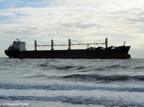
 BLUEBILL
Current Status
Where is the vessel?
BLUEBILL is currently in 16 nm E of Las Palmas, based on AIS data received about 3h ago.
Latest AIS update:
Current position: 28.50883° N, 15.86209° W (16 nm E of Las Palmas)
Average speed (last 7 days): Loading…
Average speed (last 30 days): Loading…
Vessel profile: BLUEBILL is a Bulk Carrier with dimensions m x m.
This page combines live AIS, route history, probable destination signals, nearby traffic, and port activity for practical vessel monitoring.
The current position of vessel BLUEBILL is 28.50883 lat / -15.86209 lng. Updated: 2026-04-21 18:01:33 UTCNearest reference points:
- Near San Nicolás
- Near Las Palmas
- Near Las Palmas de Gran Canaria
Currently sailing under the flag of Marshall Islands ![]()
Details:
Live Vessel BLUEBILL Analytics (details, animations, etc.)
Recent AIS points (UTC):
2026-04-21 17:26:27 UTC · 28.52208, -15.84977 · SOG 11.4 kn · COG 219°2026-04-21 18:01:33 UTC · 28.50883, -15.86209 · SOG 11.4 kn · COG 219°
2026-04-21 18:01:33 UTC · 28.50883, -15.86209 · SOG 11.4 kn · COG 219°
2026-04-21 18:01:33 UTC · 28.50883, -15.86209 · SOG 11.4 kn · COG 219°