 vesseltracker.com
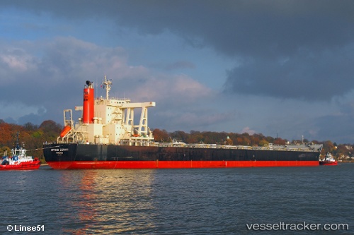
 CAPE HORN
Current Status
Where is the vessel?
CAPE HORN is currently in 77 nm N of Stybarrow Venture MV17, based on AIS data received about 1h ago.
Latest AIS update:
Current position: 20.15269° S, 113.69523° E (77 nm N of Stybarrow Venture MV17)
Average speed (last 7 days): Loading…
Average speed (last 30 days): Loading…
Vessel profile: CAPE HORN is a Bulk Carrier with dimensions m x m.
This page combines live AIS, route history, probable destination signals, nearby traffic, and port activity for practical vessel monitoring.
The current position of vessel CAPE HORN is -20.15269 lat / 113.69523 lng. Updated: 2026-04-14 23:30:19 UTCCurrently sailing under the flag of Marshall Islands ![]()
Details:
Live Vessel CAPE HORN Analytics (details, animations, etc.)
Recent AIS points (UTC):
2026-04-14 18:14:50 UTC · -21.12770, 113.51550 · SOG 10.9 kn · COG 12°2026-04-14 19:52:27 UTC · -20.83000, 113.56833 · SOG 10 kn · COG -1°
2026-04-14 22:11:00 UTC · -20.39847, 113.64939 · SOG 11.4 kn · COG 8°
2026-04-14 23:30:19 UTC · -20.15269, 113.69523 · SOG 11 kn · COG 10°