 vesseltracker.com
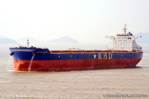
 RICHMOND
Current Status
Where is the vessel?
RICHMOND is currently in 11 nm E of Mundra, based on AIS data received less than 1h ago.
Latest AIS update:
Current position: 22.72205° N, 69.88943° E (11 nm E of Mundra)
Average speed (last 7 days): Loading…
Average speed (last 30 days): Loading…
Vessel profile: RICHMOND is a Cargo with dimensions m x m.
This page combines live AIS, route history, probable destination signals, nearby traffic, and port activity for practical vessel monitoring.
The current position of vessel RICHMOND is 22.72205 lat / 69.88943 lng. Updated: 2026-04-19 10:02:36 UTCNearest reference points:
- 12 nm N of Rozi
- Near SIKKA
- Near Mundra
Currently sailing under the flag of Marshall Islands ![]()
Details:
Live Vessel RICHMOND Analytics (details, animations, etc.)
Recent AIS points (UTC):
2026-04-19 04:09:50 UTC · 22.72060, 69.88385 · SOG 0 kn · COG -1°2026-04-19 06:07:22 UTC · 22.72230, 69.88943 · SOG 0 kn · COG -1°
2026-04-19 07:47:36 UTC · 22.72153, 69.88938 · SOG 0 kn · COG 233°
2026-04-19 10:02:36 UTC · 22.72205, 69.88943 · SOG 0 kn · COG 237°