 vesseltracker.com
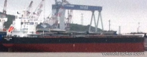
 VELA
VELA
Current Status
Where is the vessel?
VELA is currently in 202 nm NE of Primorsky Krai, based on AIS data received about 2h ago.
Latest AIS update:
Current position: 47.65667° N, 131.84669° W (202 nm NE of Primorsky Krai)
Average speed (last 7 days): Loading…
Average speed (last 30 days): Loading…
Vessel profile: VELA is a Cargo with dimensions m x m.
This page combines live AIS, route history, probable destination signals, nearby traffic, and port activity for practical vessel monitoring.
The current position of vessel VELA is 47.65667 lat / -131.84669 lng. Updated: 2026-03-29 00:45:42 UTCCurrently sailing under the flag of Marshall Islands ![]()
Details:
Live Vessel VELA Analytics (details, animations, etc.)
Recent AIS points (UTC):
2026-03-28 19:26:22 UTC · 48.21846, -133.38133 · SOG 13.1 kn · COG 118°2026-03-28 22:05:52 UTC · 47.94017, -132.61485 · SOG 13.1 kn · COG 117°
2026-03-29 00:02:52 UTC · 47.73457, -132.05141 · SOG 13.2 kn · COG 117°
2026-03-29 00:45:42 UTC · 47.65667, -131.84669 · SOG 13.4 kn · COG 117°