 vesseltracker.com
 CETUS BELUGA
Current Status
Where is the vessel?
CETUS BELUGA is currently in 83 nm S of TEBIG, based on AIS data received about 1h ago.
Latest AIS update:
Current position: 24.38558° S, 43.77437° W (83 nm S of TEBIG)
Average speed (last 7 days): Loading…
Average speed (last 30 days): Loading…
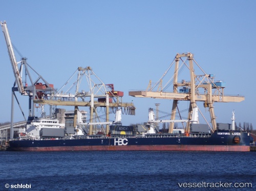
Vessel profile: CETUS BELUGA is a Cargo with dimensions m x m.
This page combines live AIS, route history, probable destination signals, nearby traffic, and port activity for practical vessel monitoring.
The current position of vessel CETUS BELUGA is -24.38558 lat / -43.77437 lng. Updated: 2026-04-19 14:05:55 UTCNearest reference points:
- 61 nm S of TEBIG
- 49 nm S of SEPETIBA
- 27 nm SW of Santos Dumont Apt/Rio de Janeiro
Currently sailing under the flag of Marshall Islands ![]()
Details:
Live Vessel CETUS BELUGA Analytics (details, animations, etc.)
Recent AIS points (UTC):
2026-04-19 10:35:43 UTC · -23.70685, -43.39979 · SOG 13.1 kn · COG 207°2026-04-19 11:35:17 UTC · -23.90167, -43.50500 · SOG 13 kn · COG -1°
2026-04-19 13:04:32 UTC · -24.18998, -43.66680 · SOG 13 kn · COG 202°
2026-04-19 14:05:55 UTC · -24.38558, -43.77437 · SOG 12.6 kn · COG 206°