 vesseltracker.com
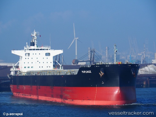
 PUPLINGE
Current Status
Where is the vessel?
PUPLINGE is currently in 37 nm NE of Valencia de San Juan, based on AIS data received about 1d ago.
Latest AIS update:
Current position: 42.84437° N, 52.79841° W (37 nm NE of Valencia de San Juan)
Average speed (last 7 days): Loading…
Average speed (last 30 days): Loading…
Vessel profile: PUPLINGE is a Cargo with dimensions m x m.
This page combines live AIS, route history, probable destination signals, nearby traffic, and port activity for practical vessel monitoring.
The current position of vessel PUPLINGE is 42.84437 lat / -52.79841 lng. Updated: 2026-04-10 07:40:33 UTCNearest reference points:
- 28 nm NE of Valencia de San Juan
Currently sailing under the flag of Marshall Islands ![]()
Details:
Live Vessel PUPLINGE Analytics (details, animations, etc.)
Recent AIS points (UTC):
2026-04-10 01:24:52 UTC · 42.50243, -51.12736 · SOG 11.5 kn · COG 286°2026-04-10 03:52:03 UTC · 42.62078, -51.74811 · SOG 11.9 kn · COG 291°
2026-04-10 05:24:41 UTC · 42.72232, -52.15800 · SOG 12.4 kn · COG 291°
2026-04-10 07:40:33 UTC · 42.84437, -52.79841 · SOG 13.2 kn · COG 285°