 vesseltracker.com
 TIANA
TIANA
Current Status
Where is the vessel?
TIANA is currently in 31 nm N of Cullen, based on AIS data received less than 1h ago.
Latest AIS update:
Current position: 58.19950° N, 2.86412° E (31 nm N of Cullen)
Average speed (last 7 days): Loading…
Average speed (last 30 days): Loading…
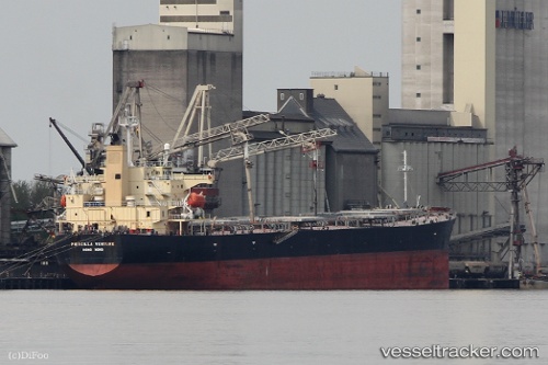
Vessel profile: TIANA is a Bulk Carrier with dimensions m x m.
This page combines live AIS, route history, probable destination signals, nearby traffic, and port activity for practical vessel monitoring.
The current position of vessel TIANA is 58.19950 lat / 2.86412 lng. Updated: 2026-04-18 16:17:24 UTCNearest reference points:
- Near Alba Oil Field
- 10 nm N of Leadon
- 19 nm W of Curlew
Currently sailing under the flag of Marshall Islands ![]()
Details:
Live Vessel TIANA Analytics (details, animations, etc.)
Recent AIS points (UTC):
2026-04-18 09:47:49 UTC · 58.49548, 0.37772 · SOG 12.6 kn · COG 108°2026-04-18 12:20:00 UTC · 58.34272, 1.34712 · SOG 12.6 kn · COG 97°
2026-04-18 13:39:12 UTC · 58.30333, 1.86500 · SOG 12 kn · COG -1°
2026-04-18 16:17:24 UTC · 58.19950, 2.86412 · SOG 12.3 kn · COG -1°