 vesseltracker.com
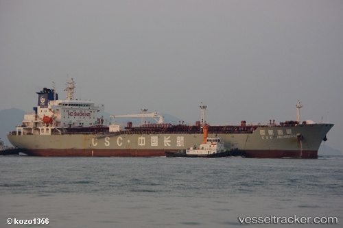
 LUCKY MAY
Current Status
Where is the vessel?
LUCKY MAY is currently in Near Changi, based on AIS data received about 1h ago.
Latest AIS update:
Current position: 1.24979° N, 103.98031° E (Near Changi)
Average speed (last 7 days): Loading…
Average speed (last 30 days): Loading…
Vessel profile: LUCKY MAY is a Oil Products Tanker with dimensions m x m.
This page combines live AIS, route history, probable destination signals, nearby traffic, and port activity for practical vessel monitoring.
The current position of vessel LUCKY MAY is 1.24979 lat / 103.98031 lng. Updated: 2026-04-12 15:44:29 UTCNearest reference points:
- Near Changi
- Near Tampines
- Near TANAH MERAH
Currently sailing under the flag of Marshall Islands ![]()
Details:
Live Vessel LUCKY MAY Analytics (details, animations, etc.)
Recent AIS points (UTC):
2026-04-12 10:00:36 UTC · 1.30648, 104.16867 · SOG 0 kn · COG 87°2026-04-12 12:15:31 UTC · 1.30657, 104.16867 · SOG 0 kn · COG 94°
2026-04-12 13:45:36 UTC · 1.30665, 104.16863 · SOG 0 kn · COG -1°
2026-04-12 15:44:29 UTC · 1.24979, 103.98031 · SOG 8.8 kn · COG 250°