 vesseltracker.com
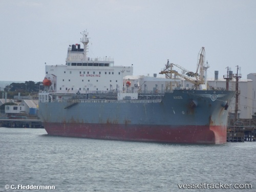
 VALIANTA
Current Status
Where is the vessel?
VALIANTA is currently in 389 nm E of Suqutrá, based on AIS data received about 1h ago.
Latest AIS update:
Current position: 12.37667° N, 60.63667° E (389 nm E of Suqutrá)
Average speed (last 7 days): Loading…
Average speed (last 30 days): Loading…
Vessel profile: VALIANTA is a Chemical/Oil Products Tanker with dimensions 183m x 32m.
This page combines live AIS, route history, probable destination signals, nearby traffic, and port activity for practical vessel monitoring.
The current position of vessel VALIANTA is 12.37667 lat / 60.63667 lng. Updated: 2026-04-10 03:14:48 UTCNearest reference points:
- Open sea, approx. 438 nm off the nearest listed port
- Open sea, approx. 437 nm off the nearest listed port
- Open sea, approx. 433 nm off the nearest listed port
Currently sailing under the flag of Marshall Is ![]()
VALIANTA built in 2006 year
Deadweight:
46792 tDetails:
Live Vessel VALIANTA Analytics (details, animations, etc.)
Recent AIS points (UTC):
2026-04-09 21:48:51 UTC · 12.12000, 61.58833 · SOG 10 kn · COG -1°2026-04-10 00:01:39 UTC · 12.22166, 61.20500 · SOG 10 kn · COG -1°
2026-04-10 01:38:16 UTC · 12.30166, 60.92333 · SOG 10 kn · COG -1°
2026-04-10 03:14:48 UTC · 12.37667, 60.63667 · SOG 11 kn · COG -1°