 vesseltracker.com
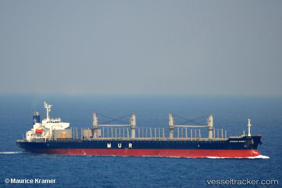
 MANTA URAZ
Current Status
Where is the vessel?
MANTA URAZ is currently in 193 nm SW of Nagybajom, based on AIS data received less than 1h ago.
Latest AIS update:
Current position: 43.89424° N, 170.26846° E (193 nm SW of Nagybajom)
Average speed (last 7 days): Loading…
Average speed (last 30 days): Loading…
Vessel profile: MANTA URAZ is a Cargo with dimensions m x m.
This page combines live AIS, route history, probable destination signals, nearby traffic, and port activity for practical vessel monitoring.
The current position of vessel MANTA URAZ is 43.89424 lat / 170.26846 lng. Updated: 2026-04-22 11:25:29 UTCCurrently sailing under the flag of Marshall Islands ![]()
Details:
Live Vessel MANTA URAZ Analytics (details, animations, etc.)
Recent AIS points (UTC):
2026-04-22 07:38:50 UTC · 43.96255, 171.10001 · SOG 9 kn · COG 265°2026-04-22 09:55:40 UTC · 43.91784, 170.61520 · SOG 9.9 kn · COG 268°
2026-04-22 10:13:14 UTC · 43.91260, 170.54964 · SOG 10 kn · COG 268°
2026-04-22 11:25:29 UTC · 43.89424, 170.26846 · SOG 10.3 kn · COG 268°