 vesseltracker.com
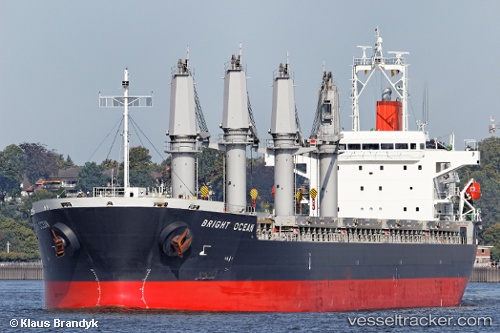
 LOUISE
Current Status
Where is the vessel?
LOUISE is currently in 134 nm SE of Aracaju, based on AIS data received about 1h ago.
Latest AIS update:
Current position: 12.70378° S, 35.52973° W (134 nm SE of Aracaju)
Average speed (last 7 days): Loading…
Average speed (last 30 days): Loading…
Vessel profile: LOUISE is a Bulk Carrier with dimensions m x m.
This page combines live AIS, route history, probable destination signals, nearby traffic, and port activity for practical vessel monitoring.
The current position of vessel LOUISE is -12.70378 lat / -35.52973 lng. Updated: 2026-04-23 00:03:06 UTCNearest reference points:
- Near Aracaju
- 157 nm SE of Maceio
- Near Barra dos Coqueiros
Currently sailing under the flag of Marshall Islands ![]()
Details:
Live Vessel LOUISE Analytics (details, animations, etc.)
Recent AIS points (UTC):
2026-04-22 20:15:12 UTC · -11.93764, -35.35285 · SOG 12.1 kn · COG 190°2026-04-22 21:59:25 UTC · -12.29069, -35.44065 · SOG 12.5 kn · COG 189°
2026-04-22 23:04:12 UTC · -12.50835, -35.48809 · SOG 12.2 kn · COG 189°
2026-04-23 00:03:06 UTC · -12.70378, -35.52973 · SOG 12.1 kn · COG 189°