 vesseltracker.com
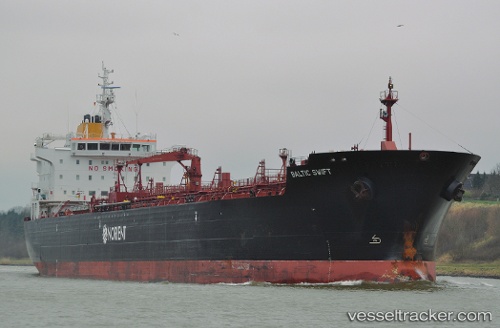
 SWIFT
SWIFT
Current Status
Where is the vessel?
SWIFT is currently in Near Arica, based on AIS data received less than 1h ago.
Latest AIS update:
Current position: 18.48158° S, 70.34692° W (Near Arica)
Average speed (last 7 days): Loading…
Average speed (last 30 days): Loading…
Vessel profile: SWIFT is a Oil/Chemical Tanker with dimensions m x m.
This page combines live AIS, route history, probable destination signals, nearby traffic, and port activity for practical vessel monitoring.
The current position of vessel SWIFT is -18.48158 lat / -70.34692 lng. Updated: 2026-04-13 17:30:00 UTCNearest reference points:
- Near Arica
- Near Matarani
Currently sailing under the flag of Marshall Islands ![]()
Details:
Live Vessel SWIFT Analytics (details, animations, etc.)
Recent AIS points (UTC):
2026-04-13 11:40:35 UTC · -18.48141, -70.34686 · SOG 0.4 kn · COG 298°2026-04-13 14:13:41 UTC · -18.48201, -70.34928 · SOG 0.4 kn · COG 5°
2026-04-13 16:01:41 UTC · -18.48184, -70.34852 · SOG 0.2 kn · COG 331°
2026-04-13 17:30:00 UTC · -18.48158, -70.34692 · SOG 0.8 kn · COG 282°