 vesseltracker.com
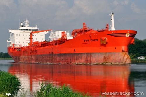
 BOW CHAIN
Current Status
Where is the vessel?
BOW CHAIN is currently in 104 nm SE of Quintana, based on AIS data received less than 1h ago.
Latest AIS update:
Current position: 27.76884° N, 93.83348° W (104 nm SE of Quintana)
Average speed (last 7 days): Loading…
Average speed (last 30 days): Loading…
Vessel profile: BOW CHAIN is a Oil/Chemical Tanker with dimensions m x m.
This page combines live AIS, route history, probable destination signals, nearby traffic, and port activity for practical vessel monitoring.
The current position of vessel BOW CHAIN is 27.76884 lat / -93.83348 lng. Updated: 2026-04-21 01:24:43 UTCNearest reference points:
- 63 nm SE of Quintana
- 56 nm SE of Quintana
- 49 nm SE of Sheppard
Currently sailing under the flag of Marshall Islands ![]()
Details:
Live Vessel BOW CHAIN Analytics (details, animations, etc.)
Recent AIS points (UTC):
2026-04-20 22:16:24 UTC · 27.82115, -93.10534 · SOG 12.2 kn · COG 265°2026-04-20 23:33:55 UTC · 27.80059, -93.40256 · SOG 12.3 kn · COG 264°
2026-04-20 23:33:55 UTC · 27.80059, -93.40256 · SOG 12.3 kn · COG 264°
2026-04-21 01:24:43 UTC · 27.76884, -93.83348 · SOG 12.4 kn · COG 260°