 vesseltracker.com
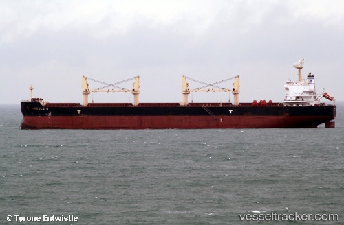
 ANGELE N
Current Status
Where is the vessel?
ANGELE N is currently in 35 nm SW of LHOKNGA, based on AIS data received about 2h ago.
Latest AIS update:
Current position: 5.13689° N, 94.73816° E (35 nm SW of LHOKNGA)
Average speed (last 7 days): Loading…
Average speed (last 30 days): Loading…
Vessel profile: ANGELE N is a Bulk Carrier with dimensions m x m.
This page combines live AIS, route history, probable destination signals, nearby traffic, and port activity for practical vessel monitoring.
The current position of vessel ANGELE N is 5.13689 lat / 94.73816 lng. Updated: 2026-04-12 17:16:01 UTCNearest reference points:
- 48 nm NW of Sebang
- 28 nm NW of Sebang
- 80 nm W of Sebang
Currently sailing under the flag of Marshall Islands ![]()
Details:
Live Vessel ANGELE N Analytics (details, animations, etc.)
Recent AIS points (UTC):
2026-04-12 13:44:19 UTC · 5.68528, 94.23475 · SOG 12.8 kn · COG -1°2026-04-12 15:21:10 UTC · 5.41927, 94.44074 · SOG 12.5 kn · COG -1°
2026-04-12 17:16:01 UTC · 5.13689, 94.73816 · SOG 12.5 kn · COG 138°
2026-04-12 17:16:01 UTC · 5.13689, 94.73816 · SOG 12.5 kn · COG 138°