 vesseltracker.com
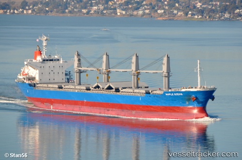
 ELIAS
ELIAS
Current Status
Where is the vessel?
ELIAS is currently in 40 nm SE of San Clodio, based on AIS data received less than 1h ago.
Latest AIS update:
Current position: 48.11431° N, 6.45634° W (40 nm SE of San Clodio)
Average speed (last 7 days): Loading…
Average speed (last 30 days): Loading…
Vessel profile: ELIAS is a Bulk Carrier with dimensions m x m.
This page combines live AIS, route history, probable destination signals, nearby traffic, and port activity for practical vessel monitoring.
The current position of vessel ELIAS is 48.11431 lat / -6.45634 lng. Updated: 2026-04-20 10:51:57 UTCNearest reference points:
- 35 nm SW of Ile D’Ouessant
- 60 nm SE of San Clodio
- 46 nm W of SEIN
Currently sailing under the flag of Marshall Islands ![]()
Details:
Live Vessel ELIAS Analytics (details, animations, etc.)
Recent AIS points (UTC):
2026-04-20 07:06:32 UTC · 48.79481, -5.86507 · SOG 11 kn · COG -1°2026-04-20 08:03:40 UTC · 48.63632, -6.01236 · SOG 12 kn · COG 215°
2026-04-20 10:21:49 UTC · 48.20868, -6.37484 · SOG 13 kn · COG 209°
2026-04-20 10:51:57 UTC · 48.11431, -6.45634 · SOG 13 kn · COG 207°