 vesseltracker.com
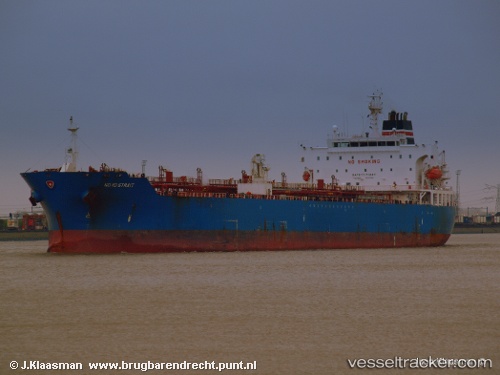
 WELL SAIL
Current Status
Where is the vessel?
WELL SAIL is currently in Near Camp Bucca, based on AIS data received about 1h ago.
Latest AIS update:
Current position: 30.12333° N, 47.91167° E (Near Camp Bucca)
Average speed (last 7 days): Loading…
Average speed (last 30 days): Loading…
Vessel profile: WELL SAIL is a Oil/Chemical Tanker with dimensions m x m.
This page combines live AIS, route history, probable destination signals, nearby traffic, and port activity for practical vessel monitoring.
The current position of vessel WELL SAIL is 30.12333 lat / 47.91167 lng. Updated: 2026-04-18 11:47:06 UTCNearest reference points:
- Near KHOR AL ZUBAIR
- Near Abadan
- Near Doha
Currently sailing under the flag of Marshall Islands ![]()
Details:
Live Vessel WELL SAIL Analytics (details, animations, etc.)
Recent AIS points (UTC):
2026-04-18 05:39:34 UTC · 29.55856, 48.81294 · SOG 10.2 kn · COG -1°2026-04-18 07:39:38 UTC · 29.78667, 48.52167 · SOG 10 kn · COG -1°
2026-04-18 09:22:12 UTC · 29.96333, 48.24667 · SOG 10 kn · COG -1°
2026-04-18 11:47:06 UTC · 30.12333, 47.91167 · SOG 10 kn · COG -1°