 vesseltracker.com
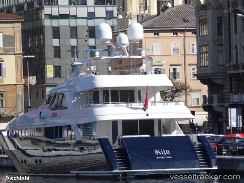
 KIJO
KIJO
Current Status
Where is the vessel?
KIJO is currently in Near SANREMO, based on AIS data received about 21h ago.
Latest AIS update:
Current position: 43.81757° N, 7.79002° E (Near SANREMO)
Average speed (last 7 days): Loading…
Average speed (last 30 days): Loading…
Vessel profile: KIJO is a Yacht with dimensions m x m.
This page combines live AIS, route history, probable destination signals, nearby traffic, and port activity for practical vessel monitoring.
The current position of vessel KIJO is 43.81757 lat / 7.79002 lng. Updated: 2026-04-10 07:25:52 UTCNearest reference points:
- Near SANREMO
- Near Arma di Taggia
- Near Riva Ligure
Currently sailing under the flag of Marshall Islands ![]()
Details:
Live Vessel KIJO Analytics (details, animations, etc.)
Recent AIS points (UTC):
2026-04-10 02:25:52 UTC · 43.81758, 7.79000 · SOG 0 kn · COG 354°2026-04-10 03:49:54 UTC · 43.81757, 7.79000 · SOG 0 kn · COG 355°
2026-04-10 05:52:53 UTC · 43.81758, 7.79000 · SOG 0 kn · COG 354°
2026-04-10 07:25:52 UTC · 43.81757, 7.79002 · SOG 0 kn · COG 354°