 vesseltracker.com
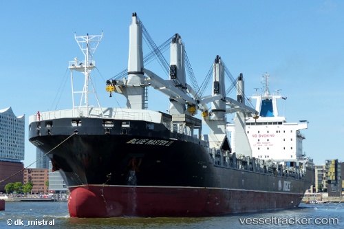
 Blue Master Ii
Current Status
Where is the vessel?
Blue Master Ii is currently in 216 nm S of San Antonio de Palé, based on AIS data received less than 1h ago.
Latest AIS update:
Current position: 4.95418° S, 6.17349° E (216 nm S of San Antonio de Palé)
Average speed (last 7 days): Loading…
Average speed (last 30 days): Loading…
Vessel profile: Blue Master Ii is a Multi Purpose Carrier with dimensions 200m x 30m.
This page combines live AIS, route history, probable destination signals, nearby traffic, and port activity for practical vessel monitoring.
The current position of vessel Blue Master Ii is -4.95418 lat / 6.17349 lng. Updated: 2026-04-19 07:30:10 UTCCurrently sailing under the flag of Marshall Is ![]()
Blue Master Ii built in 2013 year
Deadweight:
37444 tDetails:
Live Vessel Blue Master Ii Analytics (details, animations, etc.)
Recent AIS points (UTC):
2026-04-19 01:21:29 UTC · -4.37045, 5.09332 · SOG 11.8 kn · COG 118°2026-04-19 03:56:02 UTC · -4.61167, 5.54333 · SOG 12 kn · COG -1°
2026-04-19 05:35:59 UTC · -4.77005, 5.83773 · SOG 12.1 kn · COG 118°
2026-04-19 07:30:10 UTC · -4.95418, 6.17349 · SOG 12.1 kn · COG 119°